Westerville, OH - A historic map of Franklin County from 1856 – recently discovered in the Westerville History Museum’s collection - will soon be preserved for future generations thanks to a grant from the federal Institute of Museum and Library Services (IMLS), awarded by the State Library of Ohio.
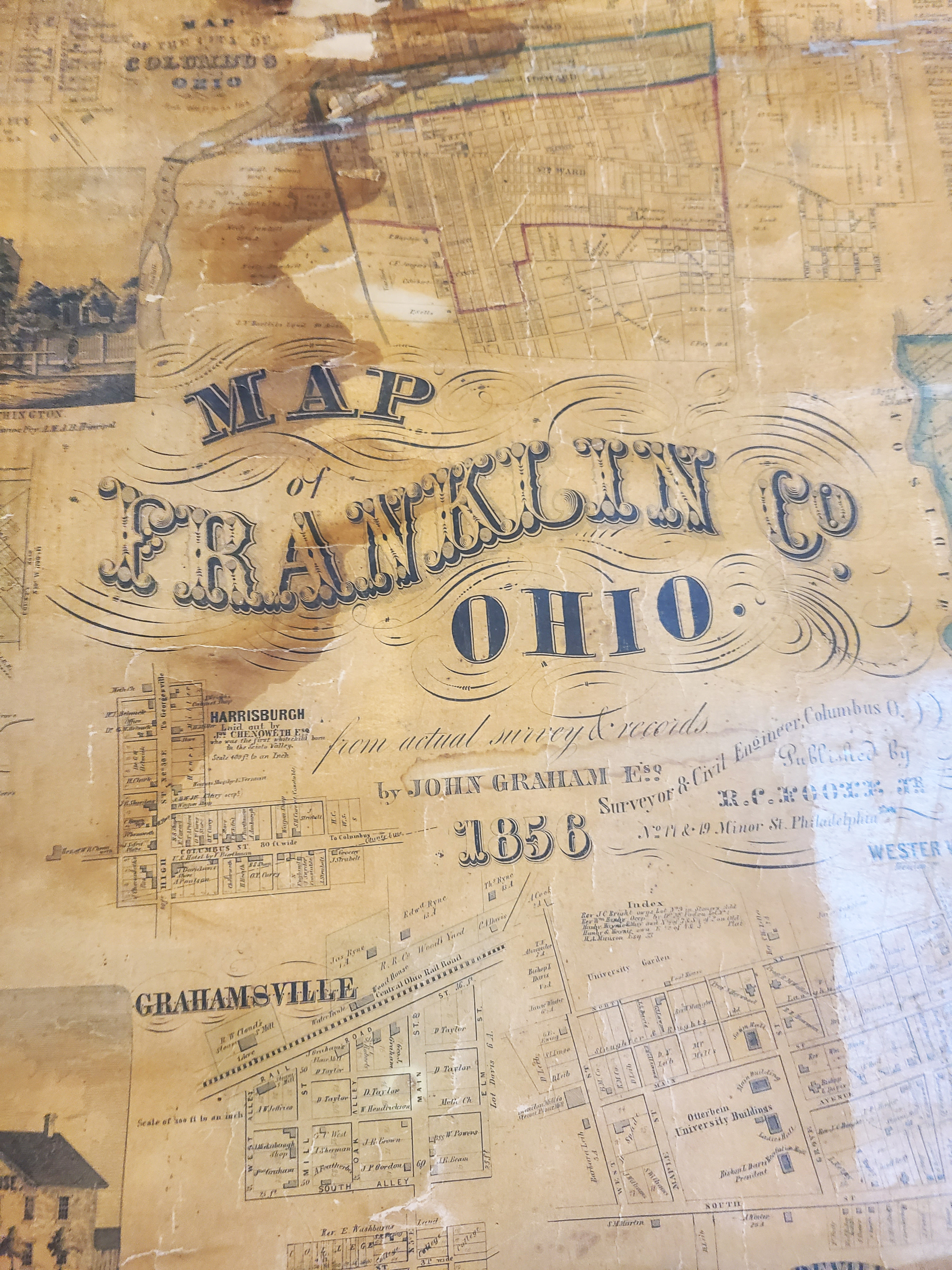
Cracked and torn in several places, this large 4-foot by 5-foot map (created by John Graham) details the 18 townships located within Franklin County, along with several areas specifically focusing on Westerville including vignettes of Otterbein College, the Amalthea area, and Blendon Township. No longer in stable condition, the Westerville History Museum applied for a grant to cover the cost of conservation efforts by a professional paper conservator.
“Here's a huge thank you to the State Library of Ohio, the Ohio Preservation Council, and the IMLS for this support. This grant enables us to make a significant and fragile resource available to our community and safely so,” shared Jackie Barton, Manager of the Westerville History Museum.
This map holds significant value because of the picture it paints of Westerville. In 1856, the city had not yet been officially incorporated, though it is named on the map in the Blendon Township section. Also visible are land plots owned by notable Westerville community figures such as George Stoner, who built the building where the Westerville History Museum is now located, and Rev. William Hanby, co-founder of Otterbein University.
Bishop William Hanby, 15th Bishop of the Church of the United Brethren in Christ and abolitionist, and his son, Benjamin Russel Hanby, abolitionist and composer, have properties drawn out on the map as well.
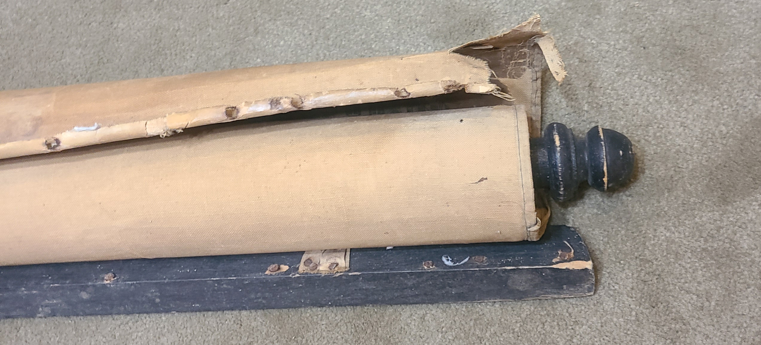
Currently, the map remains in an unused, rolled-up state out of concern for its deteriorating condition. Conservation will start in April 2026 and take a full month. After documenting the condition of the map before treatment, the map will be cleaned to remove accumulated dirt. Then, due to portions of the map lifting from its canvas backing, the backing will be removed and replaced with a new paper lining. Afterwards, any loose sections will be reattached, and losses and cracks will be mended as needed.
By getting this cleaned and restored, we're going to have something that's really big and sort of charismatic that we can display for people, and we don't really have a lot of those sorts of large-scale maps from long ago,” says Barton.
This project is supported in whole or in part by federal Institute of Museum and Library Services funds, granted through the State Library of Ohio. The opinions expressed herein do not necessarily reflect the position or policy of IMLS or the State Library of Ohio, and no official endorsement by either agency should be inferred.